On this page you will find directions from Ocala to a number of launch sites used by the Aquaholics. All launch sites are listed on subpages; that you can access either by the name of the body of water or by the Name of the Launch Site - Your Choice.
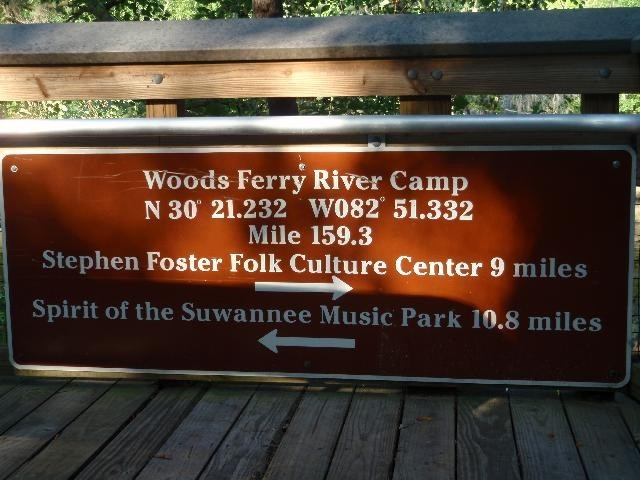
Each Launch Site has the Latitude and Longitude Coordinates for use with GPS units. Please remember that these numbers are not a substitute for maps or written directions, but rather a way of supplementing those traditional methods. Also, we do not claim that these numbers are 100% accurate. They should put you in the vicinity of a given launch point, but it may be the parking lot, the entrance to a park, the middle of the river, or a quarter mile upstream (or more!!!). It all depends on the individual marking it as well as the accuracy and location of the GPS unit used to mark it. Also, depending on your GPS, the age of teh maps within and your settings it might not take you the best way there - so please bring writtendirections with you.
Check out the Map It!! at launch sites - Click on it and you will go to Goggle Maps to the location.
If you notice a particular launch site is not included, send an e-mail with the launch site's name and directions from Ocala to the webmaster at webmaster@mcaquaholics.com. I will add it as soon as I can.
At bottom - is Map courtesy of Paddling.Net
Site Directions